About Geophysical Survey Flights
With a specially equipped aircraft that is owned
and operated by
Wermlandsflyg AB in Torsby, Sweden,
SGU - Sveriges Geologiska Undersökningar (Geological
Survey of Sweden), performs geophysical survey flights
in Sweden every summer. The onboard equipment register the
magnetic field variation, the soil's
electrical conductivity
and the gamma radiation. With these three
parameters, you will get a picture of the bedrock hundreds of
feet into the ground. This special geophysical survey flight
has been ongoing in Sweden every summer since the early
1960s.
For researchers, it would be ideal if the
aircraft flew three feet above the ground at the same speed
the onboard computers where capable of collecting data (i.e.
very low and very quickly). But a method has been
developed so you fly at an altitude of 200 feet and a speed
of 135 knots instead, and still get good enough data for the
researchers. The selected altitude and speed is based on
safety and on the airplanes performance, efficiency and fuel
economy. The flight route is a imaginary line in the air,
usually in an east-west direction (or opposite). The length
of the lines varies, but are usually from a few kilometers
up to a hundred kilometers long. At the end of each line,
you climb slightly, make a turn and then descend down to
your low survey altitude again and fly back in the opposite
direction, 200 meters parallel from the line you just flew.
You continue to fly the lines, back and forth - much like
when you harvest a field - until the whole area is
completed. During favorable conditions, it is possible to
fly up to 600 km at a single mission, which corresponds to a
120 km² area.
All the flights are preformed manually without any autopilot, but a
specially developed GPS is installed to assist the Pilot, and also a radar
altimeter. At the cockpits right seat the Navigator is seated. Prior to the
flight, the Navigator assist the Pilot and reconnoiter the aerial maps and the
expected obstacles. During the flight the Navigator keep track of the position
and inform the pilot about any obstacles. Examples of obstacles are power lines,
masts, wind turbines and high towers of various kinds. When you pass lower
obstacles such as mobile phone masts and wind turbines (usually around 260 feet
high) you usually climb slightly and passes them on top. Higher obstacles, such as
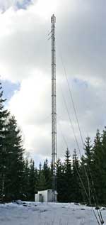
TV- and radio masts (which may be up to 1000 feet high, and often have long and
wide supporting wires) you fly around and passing them at a safe distance. At
these high mast locations no data can be collected, but the blank spots is
relatively small and the data can often be interpolated at these locations.
The requirements for operations at low altitudes are high. You have
to fly low
and fast with high precision, without compromise the safety. The low
altitude means that you also are exposed to significantly higher strain than at
"normal" flight. Including, risk of bird strikes are significant
higher and the constant need to adopt to the underlying
terrain variations and various obstacles. Moreover, flights at low altitude
means that you are often exposed to greater
turbulence due to the wind (ground friction), but also because of the sun is heating
up the ground during daytime. To avoid that, the flights are taking placed during the
times of day when the wind is weak and the solar radiation are low, i.e. usually during early
mornings and late evenings. (With the consequence that the crew often gets blinded by the low sun).
Furthermore, the crew must all the time keep an eye out for other low-flying
aircraft and helicopters, especially if you are operating in the vicinity of an airport.
In other words, flying low leads to higher risks and greater pressures on
both human and material, but with proper training, good planning and right
attitude of the flying crew, these special low altitude missions are as safe as
"normal" flight.
In order to legally operate an aircraft professionally at low altitudes
the Aviation Authorities requires that you posses a so-called Low Flying
License. Such license is issued by the companies engaged in the aerial work at
low altitudes and is limited to be valid only for professional use. The training
includes both theory and practice.
Copyright © FlyLow
